
 Photo Credit: David Clow, flickr.com
Out of the 1,866,291 acres of Maryland's lower eastern shore consisting of urban area, agriculture, forests, water, and other ecosystems; 184,489 acres are considered wetland. This includes tidal and non tidal wetlands which cover about 10% of the area[1].
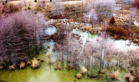
Tidal wetlands are found all along the coast of Maryland and many other states. They are areas where land meets a body of water that is affected by tides. The wetlands can either be freshwater or saltwater, but they are very often a mixture of both which is called brackish water. Many salt marshes in Wicomico county are located near the mouths of main rivers such as the Nanticoke river and the Wicomico river. The vegetation in this type of wetland are adapted to the always changing levels of salinity that come with the tides. Many of the plants in tidal wetlands also provide extremely important and species specific nesting and nursery areas.
In the Sustainable Forest Management Plan for Chesapeake Forest Lands, it is stressed that sea level rise has an effect on tidal wetlands. Sea level rise has caused tides to move further inland than they once did. This is causing many issues with managing these areas of low elevation, high seas, and high tides. Sea level rise in tidal wetlands will also cause a decrease in biodiversity[2]. Many of the low salt tolerant plants will be replaced with high salt tolerant plants, many of them invasive species not native to Wicomico county.
Saltwater, freshwater, and brackish wetlands are all expected to decline in terms of acreage over the next 82 years and be replaced with open water because of sea level rise.
Types of Tidal Wetlands:
Often form inland from saltwater tidal wetlands and along tidal rivers such as the Nanticoke and Wicomico. Even though they contain freshwater, they are still affected by the rising and falling of the tides. This means they also can be affected by flooding from climate change and more specifically, sea level rise[3]. Freshwater wetlands provide essential habitat to many bird species, including resident and migratory birds. Saltwater intrusion into a freshwater wetland from flooding can be devastating to the vegetation and animal species that call it home.
These are coastal wetlands that are regularly flooded by tides. Saltwater wetlands contain species of plants and animals that are specially adapted to high levels of salt. They also have a very thick mud layer made up of decomposing plant matter[3].
This type of wetland is a mix of fresh and saltwater. It also contains higher plant diversity and soil organic matter than saltwater marshes[3]. Brackish wetlands are the most abundant in Wicomico County.
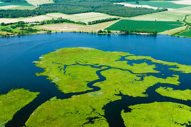
Photo Credit: Chesapeake Bay Program, flickr.com
References
1. Forest Service Home. (n.d.). Retrieved from http://dnr.maryland.gov/forests/Pages/default.aspx
2. Maryland Forest Service. Maryland Department of Natural Resources. (2007). Sustainable Forest Management Plan for Chesapeake Forest Lands: Sustainable Forests for People and the Bay (Report No. 11). Sustainable Forestry Initiative. Retrieved from http://dnr.maryland.gov/forests/Documents/chesapeake/CF-SFMP_2018.pdf
3. Tidal Wetlands. (n.d.). Retrieved from https://www.nps.gov/subjects/wetlands/tidal.htm
Header Photo: Chesapeake Bay Program, flickr.com
